Trail Walking Le Tilleul - Le Tilleul - Jumel - Etretat - Photo

Le Tilleul - Jumel - Etretat

© OpenStreetMap contributors
Length
Length
11.3 km
Max alt
Max alt
108 m
Uphill gradient
Uphill gradient
252 m
Km-Effort
Km-Effort  
14.7 km
Min alt
Min alt
3 m
Downhill gradient
Downhill gradient
252 m
Boucle
Boucle
Yes
Creation date :
2020-09-01 15:38:18.947
Updated on :
2020-09-01 16:36:15.813

(0 Reviews)

Walking
Walking
3h08
Difficulty : Difficult

Scan this QR Code to open this trail in the SityTrail application

FREE GPS app for hiking

Logo SityTrail SityTrail

IGN / Geographical institutes

Download SityTrail from the App Store Download SityTrail from Google Play

Logo SityTrail SityTrail World

The world is yours!

Download SityTrail from the App Store Download SityTrail from Google Play Download SityTrail on Huawei AppGallery

About

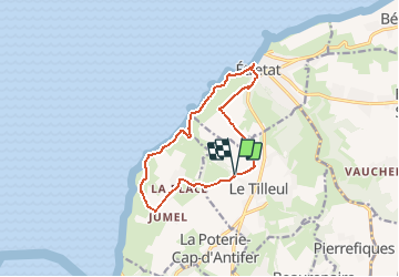
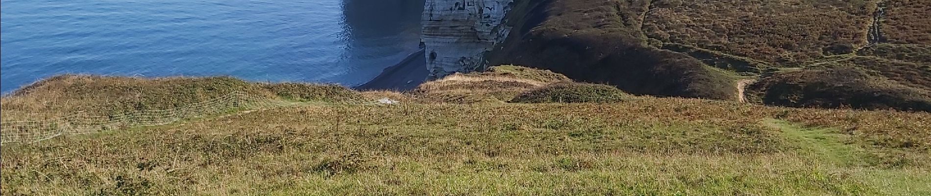
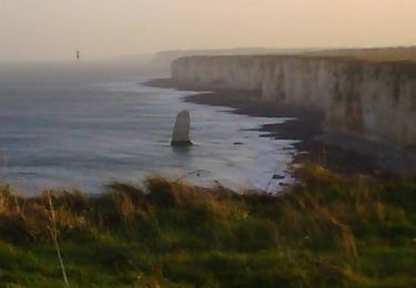
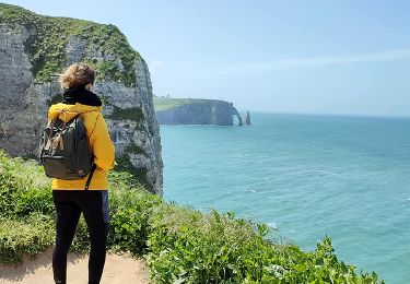
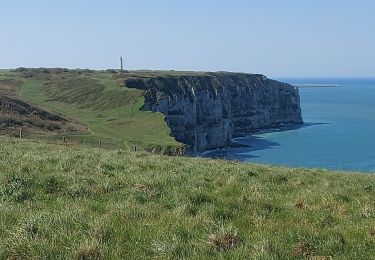
Trail Walking of 11.3 km to be discovered at Normandy, Seine-Maritime, Le Tilleul. This trail is proposed by DDLEDANDY.

Description

Circuit sympathique sur lequel on croise de belles maisons, et dont le tiers du parcours qui se déroule en bordure de falaise offre un joli point de vue sur la mer et la côte d'albâtre. A faire absolument par beau temps, si possible un jour avec peu de vent et surtout le matin, période durant laquelle les couleurs de la nature sont plus vives.

Elevation profile

Photos

Positioning

Country:
France
Region :
Normandy
Department/Province :
Seine-Maritime
Municipality :
Le Tilleul
Location:
Unknown
Start:(UTM)
297761 ; 5507545 (31U) N.

Trails nearby

Trail Walking Étretat - étretat golf  - Photo
Walking
crocheval

Walking

Easy
(1)
Étretat, Normandy, Seine-Maritime, France
4.7 km | 6.7 km-effort
1h 42min
Yes
Trail Walking Étretat - Le sentier nature des falaises d'Etretat - Photo
Walking
tracegps

Walking

Medium
(2)
Étretat, Normandy, Seine-Maritime, France
9.3 km | 12.7 km-effort
3h 30min
Yes
Trail Mountain bike Étretat - Etretat Yport - Photo
Mountain bike
tracegps

Mountain bike

Difficult
(4)
Étretat, Normandy, Seine-Maritime, France
35 km | 43 km-effort
3h 0min
Yes
Trail Walking Le Tilleul - La Valleuse d'Antifer  - Photo
Walking
GUIDE+

Walking

Difficult
(1)
Le Tilleul, Normandy, Seine-Maritime, France
12.5 km | 16.3 km-effort
3h 42min
Yes
Trail Walking La Poterie-Cap-d'Antifer - Etretat  - Photo
Walking
patrice76

Walking

Easy
(1)
La Poterie-Cap-d'Antifer, Normandy, Seine-Maritime, France
10.6 km | 14.4 km-effort
3h 8min
Yes
Trail Walking Étretat - Etretat les falaises - Photo
Walking
yvesportier

Walking

Easy
(1)
Étretat, Normandy, Seine-Maritime, France
7.6 km | 10.2 km-effort
2h 56min
Yes
Trail Walking Étretat - GR21 Etretat à Fécamp - Photo
Walking
bergo

Walking

Easy
(1)
Étretat, Normandy, Seine-Maritime, France
16.4 km | 21 km-effort
4h 42min
No
Trail Walking Bénouville - L'aiguille de Belval - Photo
Walking
GUIDE+

Walking

Medium
Bénouville, Normandy, Seine-Maritime, France
9 km | 11.1 km-effort
2h 31min
Yes
Trail Walking Étretat - Falaise d'Etretat - Photo
Walking
Axelloceane

Walking

Easy
Étretat, Normandy, Seine-Maritime, France
9 km | 11.8 km-effort
2h 19min
Yes


Close
My subscriptions